
I’d been exercising rather consistently lately to try to improve my fitness and I wanted a bit of a challenge. While playing with the map view on the AllTrails app I stumbled across this walk. Its three peaks, summing to 800m and 21km of walking, would definitely provide that challenge! (Watch the walk on YouTube here)
Mittagong was an hour and a half drive away and I’d been told there was a famous “Pie trail” in the area so I parked at the local tourist information centre and snapped a photo of the “big pie” to send to the friend that told me about the pie trail.

The first peak, Mount Alexandria, was only a short walk from the centre. I headed off, grabbing a coffee on the way. The first highlight was Lake Alexandria. It was a pretty little lake filled with ducks and apparently some turtles which I couldn’t see. I finished my coffee as I strolled around, then headed onto the track that would take me up the mountain.
There were so many little side tracks and intersections that I had to keep checking the map to be sure I was on track. Standing at the end of a short steep section was a gorgeous brown dog, wagging it’s tail. As I got near I heard the owner shout “have you found someone!”
There were two ladies out for a walk with their dogs and as I patted the first dog they asked about where I was headed. I told them I would be doing Mount Alexandria, Ninety Acre Hill and Mount Gibraltar and they asked how long that would take. “Most of the day,” I said and they nodded as if agreeing. One of the ladies told me that on the other side of the mountain was the ruins of an old coke smelter and I was interested but I didn’t visit it as I already had a big day planned. It was a lovely chat as they seemed genuinely interested and as they left the other dog came up for some attention after realising it had missed out earlier! Thanks ladies, you gave me a lovely start to the day!
Almost immediately I walked the wrong way. The trail started to curve downhill so I checked the map and realised I should have gone straight ahead at the point where I met the ladies and their dogs. I didn’t recall seeing a trail but when I returned to that point there was a narrow bush track heading upwards. I headed on in. This was getting fun!
There were some strange looking plants along the track, looking like something from lost in space or day of the triffids. At some point I lost the track. There were some fallen trees and little paths leading away and I seem to have taken the wrong one. A look at the map showed the trail only a few meters away so I pushed on up through the bush until I found it again, running alongside a sandstone outcrop.
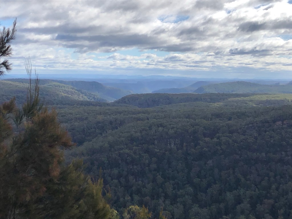
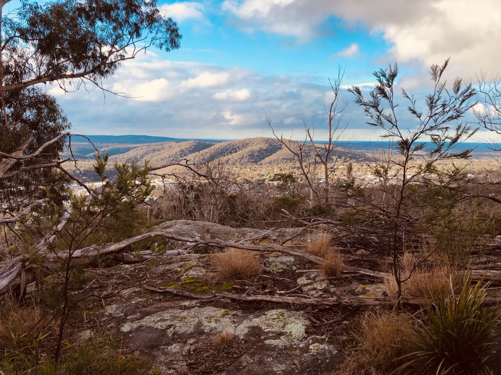
I soon reached the top and it was quite flat. It took me a moment to find the little stack of stones that marked the peak. One peak down, two to go. The map showed a lookout nearby so I went to that and was not disappointed! Amazing view! In the distance I could see a set of canyons or gorges covered in greenery and I thought that would be an excellent spot for a future visit.
I followed the track down the mountain. It became incredibly steep and I pulled the hiking poles out to help steady myself. My map showed a road and what I thought would be some road walking. I hadn’t looked at it closely enough as the motorway became a bridge and the trail descended down the mountain into a gorge!
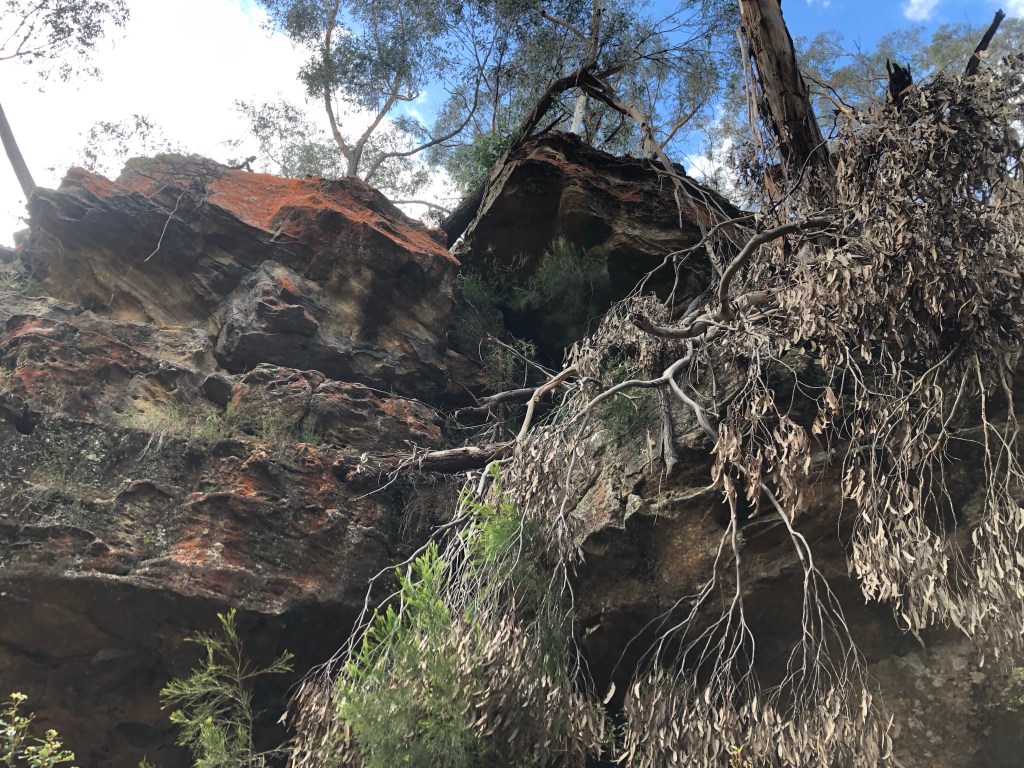
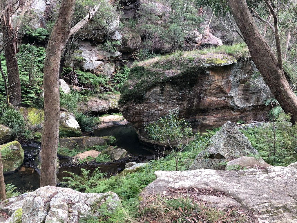
The gorge was gorgeous! It was such a surprise to me so I thoroughly enjoyed walking through it. I could see the creek at the bottom and, after walking alongside the tall red and grey walls of the canyon, the trail slowly descended to meet it.
There were some little stepping stones to cross the water and I thought this spot would be lovely to bring the kids for a picnic.
Soon enough I was out of the gorge. That could have been the end of the hike and it would have been an excellent day out. But I had my plan and I intended to finish it!


I found the road walk I had been expecting and it was as dreary and tiring on the feet as I had expected. The weather had begun to turn and I was cold and then hit then cold, switching my puffer for a rain jacket and back again. Should have just worn a fleece. By the time I entered the trail to climb Ninety Acre Hill I was not in the best mood. There was nothing wonderful about the climb, just a slow shuffle though the trees with nothing really to see. The peak itself was a little interesting. It was fairly flat ground but there was a little bump of boulders that seemed to mark the spot. There was a little turn off the main trail, marked by a fairytale looking wooden table and chair set in a greenery covered alcove. The little trail met the boulders which had the appearance of an old man’s face. Then a little climb above the boulders led me to the clump of rocks that marked the peak. As my mood had not improved I didn’t appreciate anything that I had just saw. I sat and ate something though which helped my mood greatly. As I walked away I belatedly appreciated the cuteness of the peak and it’s fairytale world.
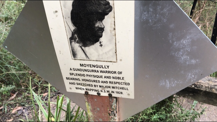
On the way down there was a spot with a photo of an Indigenous person called Moyengully Rest Area. There wasn’t any seats so I made me wonder whether this was where Moyengully himself was laid to rest. The sign said he was a warrior and was sketched by a Major Mitchell whilst mapping the area. It was an unusual spot and I’ll try to find out more but could find any details online at the time of writing.
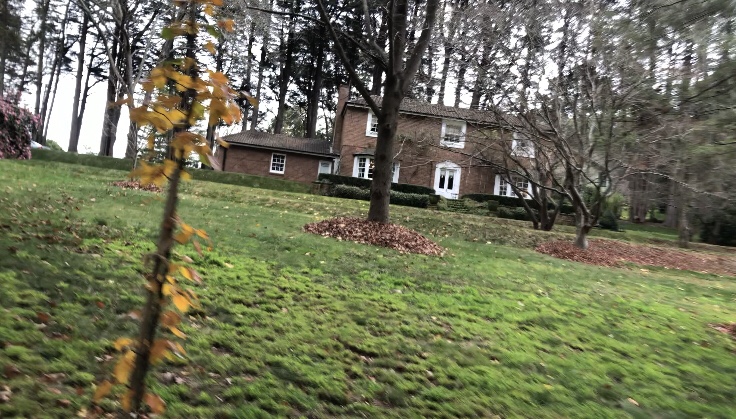
There was another road walk but it wasn’t too bad this time. It took me through an area that looked like old England. The was a manor house, lovely gardens, and even a Tudor style home on a hill!


After a little more, less interesting, road walking I reached the entrance to the track that would take me up Mount Gibraltar.
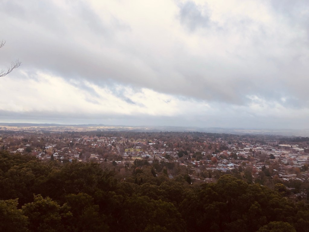
There were a lot of steps and I soon came to a sign pointing out a quarry from where the steps were obtained. I climbed and climbed, stopping frequently as I was getting proper tired now. I reach the top of the climb and checked out Bowral lookout. That was nice and although the weather had turned gloomy it was still a lovely view.
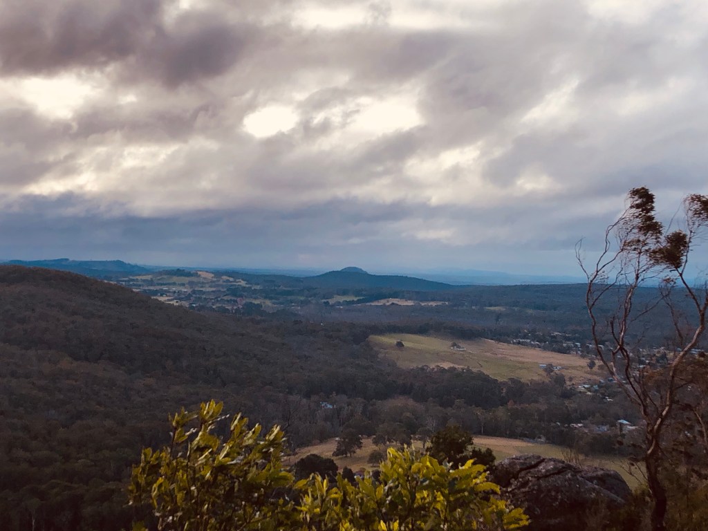
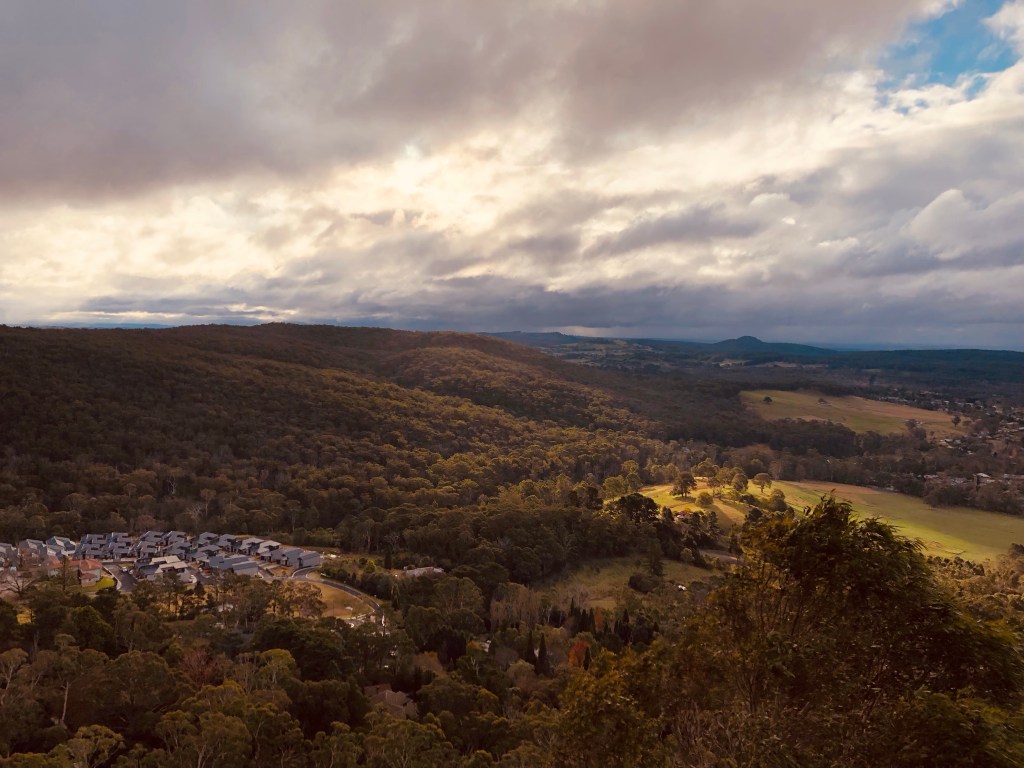
The next part of the track was called the Rim Trail and it took me along the ridge line with the view to my left opening up. The trail passed below the peak itself, which was behind a fence for a telecom tower. So I bashed thru the bush up to the road so I was at least roughly level to the peak, just so I could say I did it! Ridiculous I know. I then bashed back to the trail, though I slipped on some of the wet rocks, saved from a sore butt by my hiking poles. I carried on along the rim. The sun was starting to come out and light up the hills in the distance. I must have got distracted by the view too much as the trail vanished again. I wasn’t sure where I lost it, but I could see the road way and bashed on through to it again. This time I walked down the road a little to a lookout. I could see the other two peaks and I was a little impressed with myself for walking so far. I found the trail again and followed it to the final lookout. There was a seat in a small shelter so I sat and took in the view. Mount Alexandria was lit up beautifully nearby and it felt like the perfect end to the walk.
Only it wasn’t the end, I still had to climb down the mountain and then along the road to the car. The track down was tricky as the rocks were slippy and I had to move slowly. There was a fantastic little cave made of three intersecting boulders so I stopped for a photo and a rest. I finally reached the bottom and let my wife know I was out and heading to the car. I hadn’t quite realised that the car was another twenty minutes away! Still, I noticed that I was feeling pretty good, not huffing and puffing, no major aches and pains. My feet were throbbing and my left knee and left hip we’re starting to squeal but, standing still, I felt really normal. So I think the exercising I’d been doing is making a difference and I can see I have to keep it up just to iron out those last niggles.


Once I hit town I had pies on my mind and found a place that was open. I ended up getting a sausage roll – so much for the pie trail! A coffee woke me up enough for the drive home.
All up I think was was quite an awesome walk. You need a good map app to stay on trail and the road walking wasn’t much fun but the peaks themselves were great. I recommend doing Mount Alexandria and it’s gorge as a hike on its own if you only have a few hours as it was fantastic. Would just need to loop back to Mittagong at the end. Ninety acre hill didn’t impress me at the time but in hindsight it could be a fun little walk with the kids to see the old man rock and the fairy table. Mount Gibraltar would also be worth a stand alone visit as the rim walk had some very lovely views. The whole walk itself would be awesome to do if you were training for something as it had 21km of distance, over 800m of climbing and similar decent. I felt great after this walk and am very glad I did it.YouTube video – Southern Highlands Three Peaks Walk


Hi Nathan many years ago I lived in Mittagong and Lake Alexander was a regular spot my then young children spent many hours. I will have to go back and do the mt Alexander hike looks amazing, thank you for sharing and awesome effort, cheers Therese
LikeLiked by 1 person
When I’m out walking I’m always scouting for new places take the kids. I reckon they’d love it. Looks like a nice area to grow up, lots to explore.
LikeLike
Sounds like an interesting walk. Been to Mt Gibraltar many times but not the others. Thanks!
LikeLiked by 1 person
I thought Mount Alexandria was worth it because of the lake, the lookout and the gorge. Worth the time. I’m eager to get back and explore a little more around that area – the gorges or valleys that I saw from the lookout looked very interesting. Very nice spot. Was a very interesting walk! Thanks for reading.
LikeLike