
Walks in the Wild for OneSight 52/100km complete! Please find out more or donate by clicking here.
I thought I had finished exploring the trails leading off the Turner firetrail. I knew there were a few goat trails left but the views would not differ much. Then I noticed on my geocaching app a cache well away from the main trails. The logs mentioned a route, a bush bash and promised views so off I went!
I drove to the trailhead to start this time as I had to keep an eye on the sun. I powered through the sections of the trail that i had already visited then took an overgrown trail to the far end of the ridge top. I looked around for a bit then found the trail leading down along the ridge amongst boulders and rocky outcrops. Immediately the trail became a bit of a bush bash. I remember walking along the previous trails marvelling at the wildflowers but now they were everywhere, over growing the trail with their branches scratching me as I went. My light fleece was covered with pollen and burrs. Too much of a good thing!
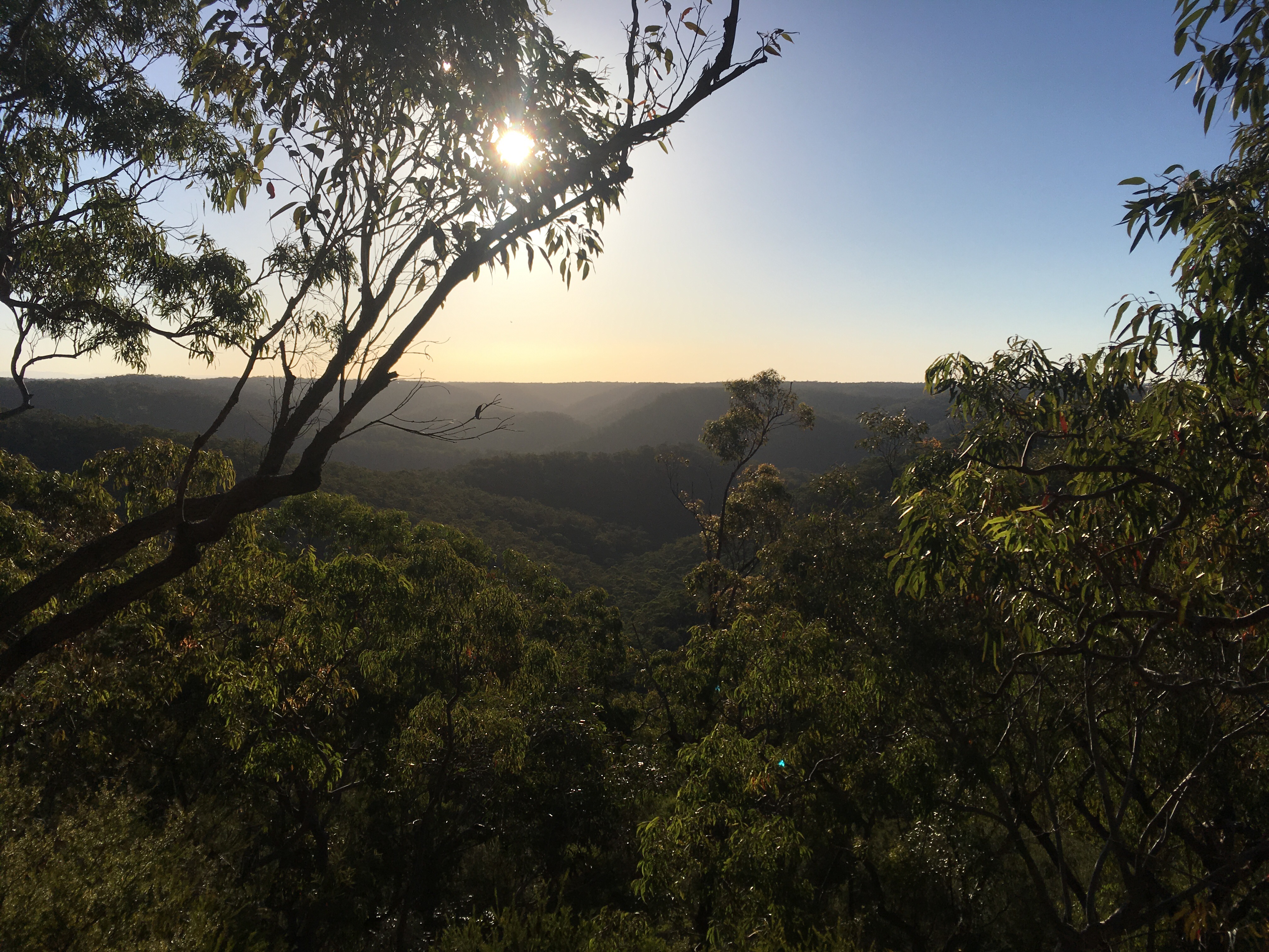
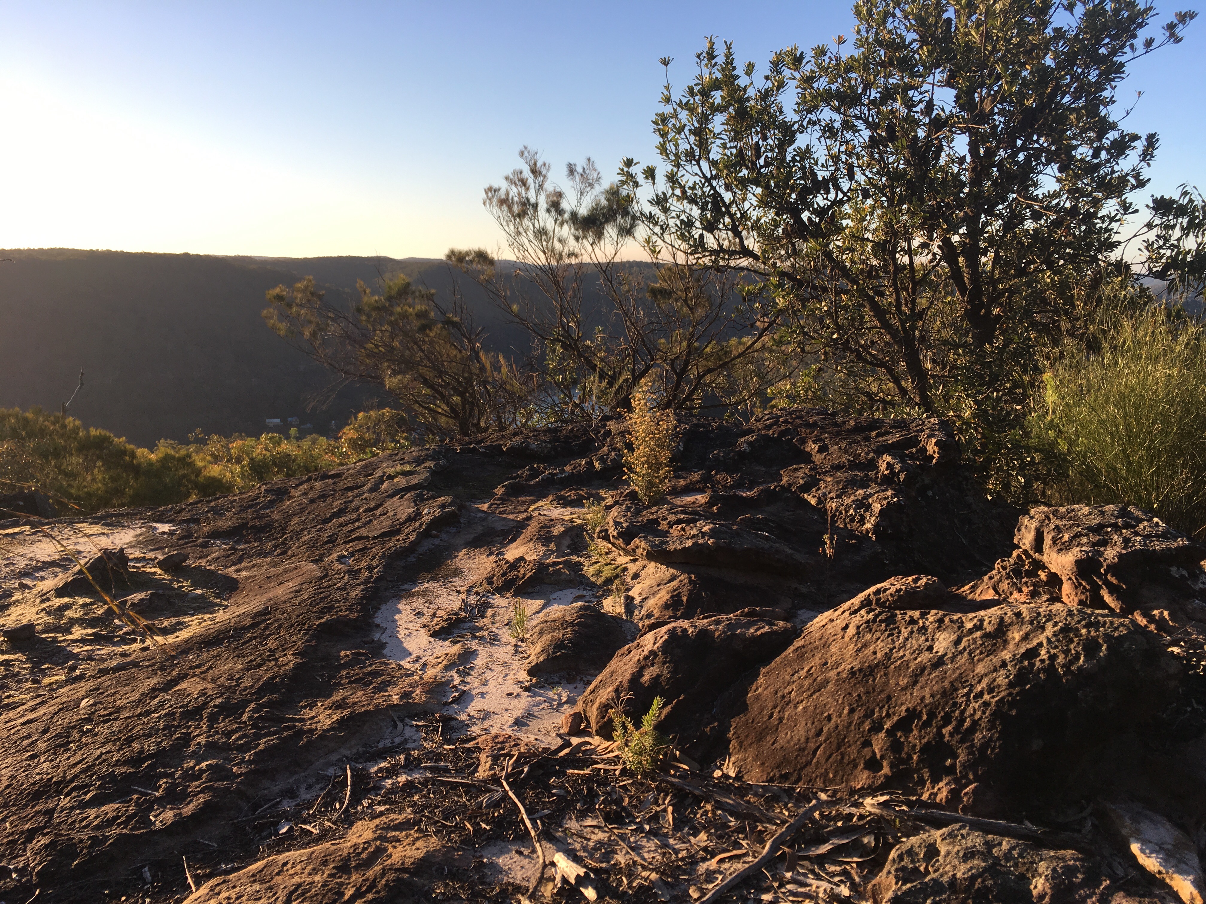
It never really let up until I came to a rocky outcrop with spectacular views! I got ready to hunt for the geocache but the app said I still had a long way to go. I checked the time and the height of the sun and kept going. I lost the trail many times but a bit of backtracking and check the map app helped me find it again soon enough. It was nothing more than a fox trail at this point. I started to notice some tape markers and rock cairns that gave reassurance that I was on the right track. I think we need a better system than tape though. It always ends up coming off and ending up on the floor.
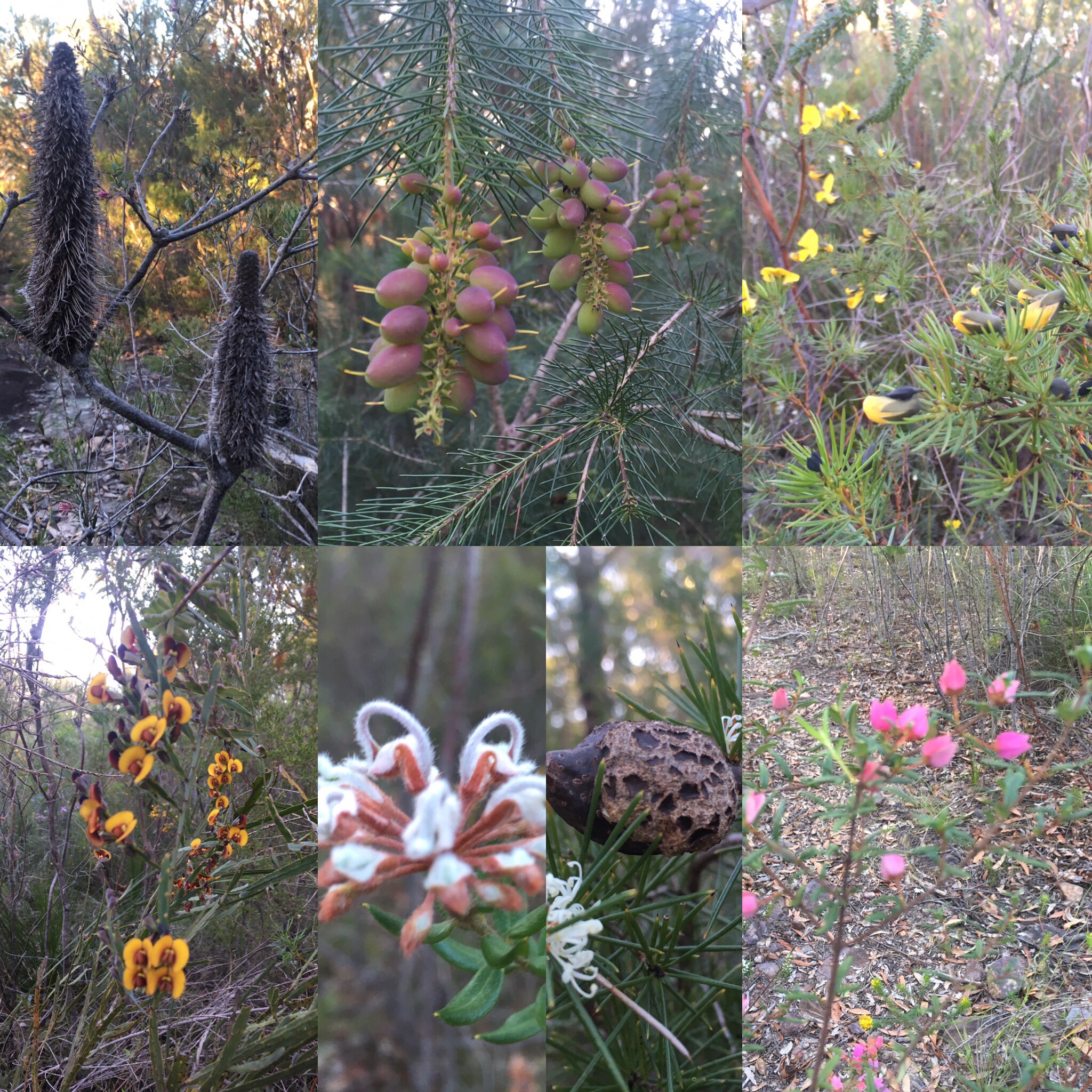
At one point where the trail had split into multiple “fox” trails I heard a massive rustle in the bush and heard a thump thump thump sound. I caught a glimpse of brown leaping away from me. A wallaby! It seemed like a big one too so maybe a roo? I tried to follow it but it bounded away again. I never got a good look at it but I was thrilled to see it! Then I wondered whether my “fox” trails were actually “roo” trails! The area was quite overgrown so the wallaby (given the colour, I think that’s what it was) would have picked up as many burrs and scratches and bits of pollen as I had. I guess that helps spread the pollen around.
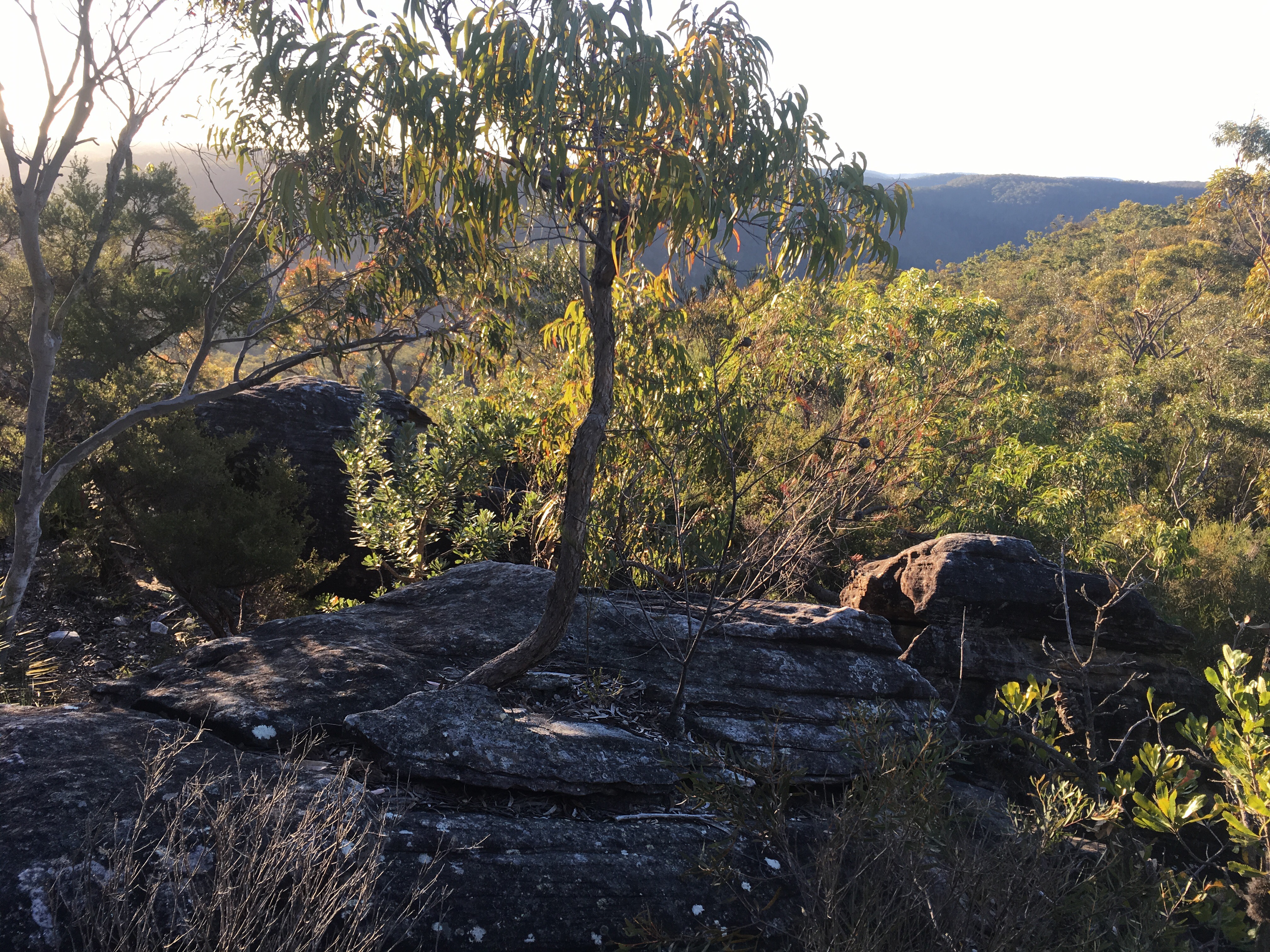
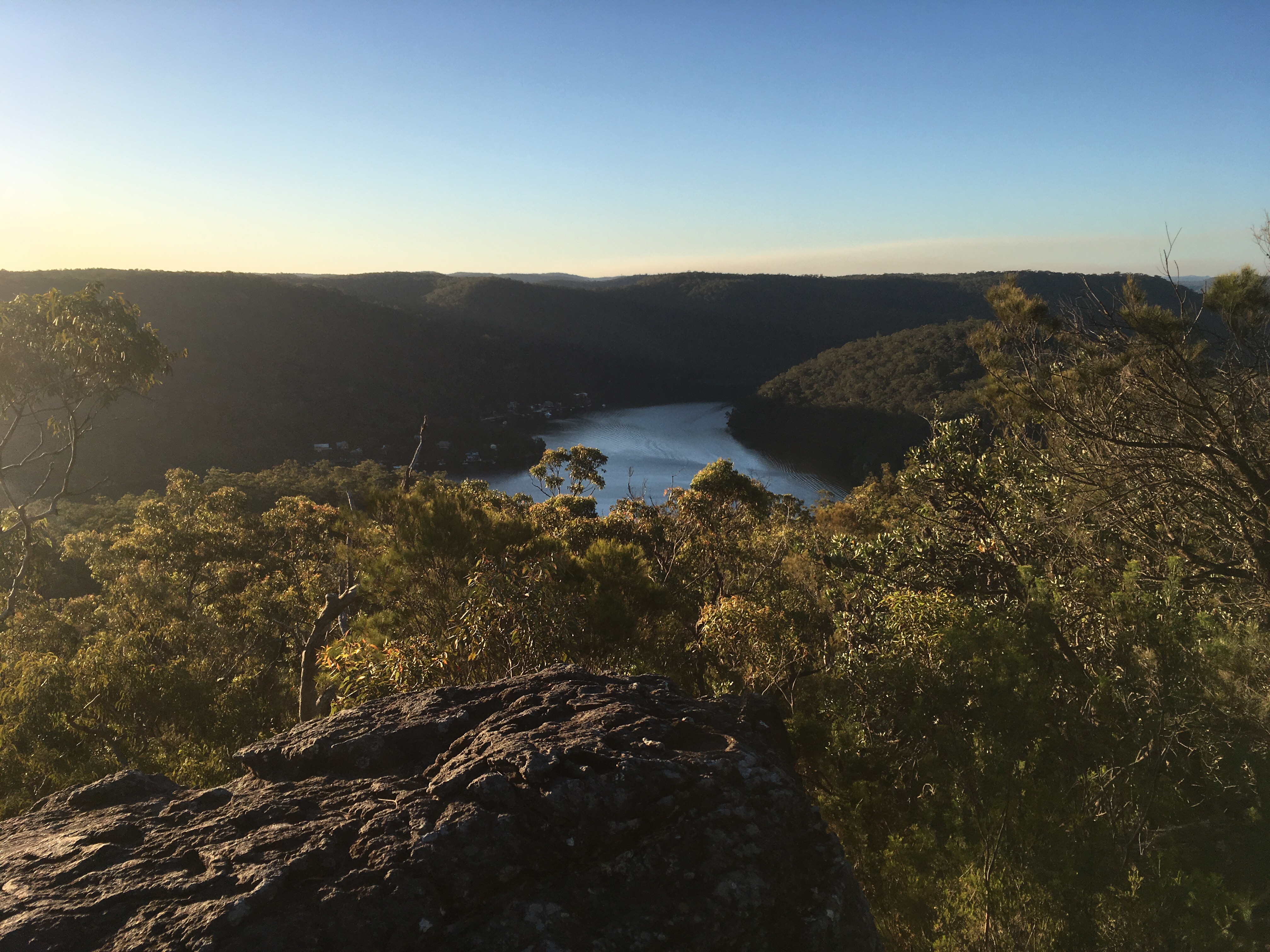
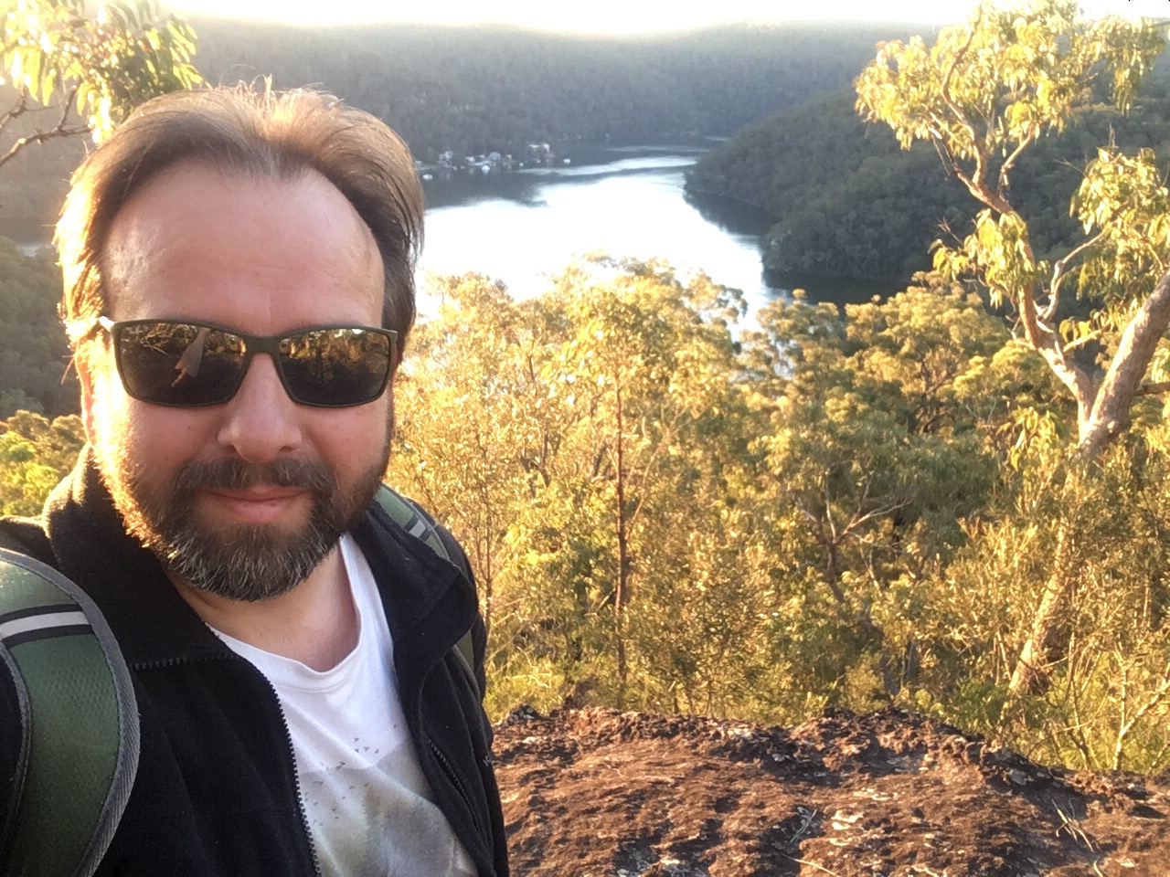
I couldn’t tell where the trail was so I used the geocaching app to guide me. I could see a rocky ledge so I headed for that and it turned out to be the right move as there was a reassuring rock cairn waiting for me. The views were amazing! I snapped some pictures then got to work trying to locate the cache. A stick got stuck in my shoe somehow and I fell flat on my face. My water bottle went flying and started sliding down the cliff! I collected it from the bush that it landed in and silently cursed myself. I had a lovely bruise form on my finger later that night. The geocaching app said that the cache (called “not another Berowra geocache”!) was in a hole in a boulder on the first ledge down. Well every boulder had a hole in it and the ledges weren’t numbered…
I had hit my return time if I wanted to get out with any daylight left so I had one last look around and called it a day. DNF. An adventure for another time.
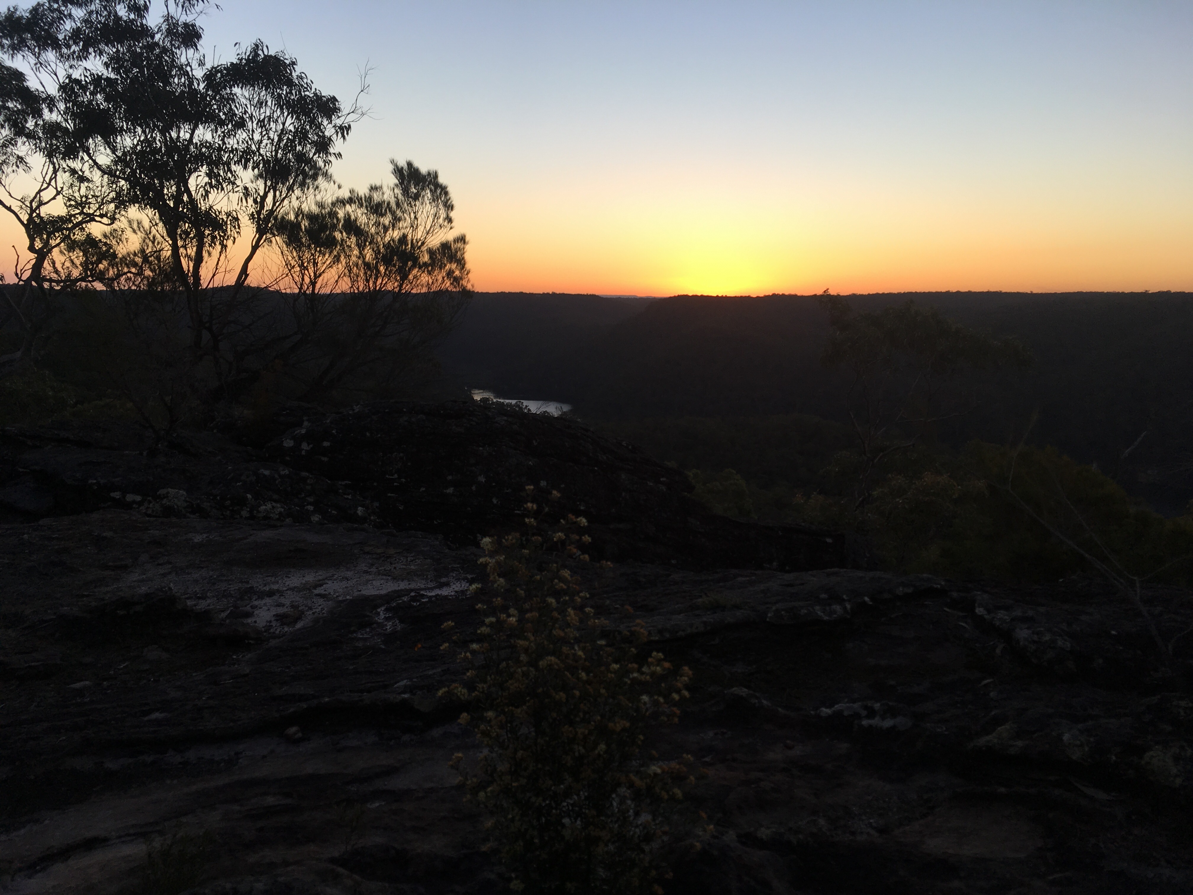
Now, where was the trail to take me out? It was impossible to find so I pulled out my route tracking app and used it to backtrack. I walked along the rock ledges,which may have been the intended route, until I was close to my trail then bashed my way through the bush to join it. I then simply followed the route back until the path was distinct enough to put the phone away. The sun was setting as I reached that first lookout so I gathered a few more pictures before pushing my way through the bush back to the main trail. It was quicker on the way out as I was familiar with the route now and the general destination was visible at points so one could have navigated quite easily based on the landforms.
I climbed the rocks and boulders up to the main trail then took to the less overgrown path back to the car. I thought I heard another thump of a wallaby but I can’t be sure.
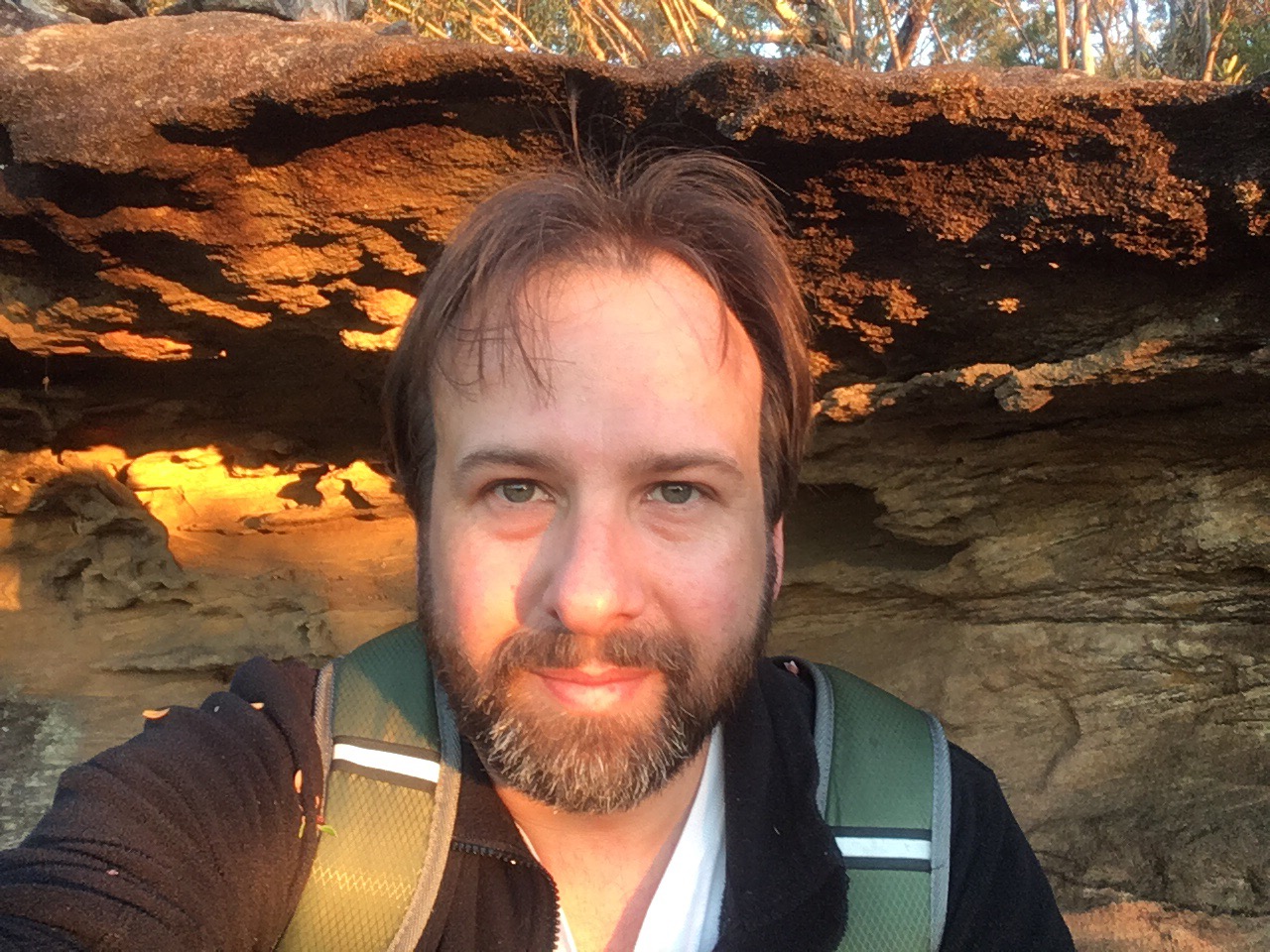
This was a fantastic little trip. It was only later that I realised that I had passed into the Muogamurra nature reserve, which is only open 6 weeks per year to protect it. Fortunately it was open at the moment but it left me wondering how many folks go walking along these little paths into the reserve anyway regardless of the time of year. If you are local and reading this, please wear long sleeves to avoid scratches and be mindful of snakes. Be prepared for off track navigation. And take a camera!
Enjoy the pictures!


I’m walking to raise funds for OneSight to provide eye care for kids and others in disadvantaged areas. Please donate, every little bit counts and it is headed somewhere worthwhile. Click here. Thank you in advance!

Fabulous! I love the photos and the videos really gave an idea of what it looks like in your neck of the woods.
LikeLiked by 1 person
Seems like a lot of reliance on electronic gizmos… hope you’re carrying spare batteries or are ready for a night in the bush, unexpectedly. 😉
LikeLiked by 1 person
It’s actually pretty easy to navigate around the area. I always carry a physical map though. I always carry spare food etc.
but I do love my gizmos
LikeLiked by 1 person
Beautiful photos!
LikeLiked by 1 person
Thank you! It’s such a beautiful area.
LikeLike