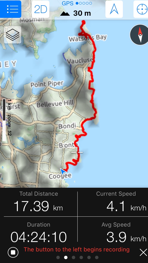
Today was another “Bloody Long Walk” charity event training walk. Watsons Bay to Coogee Beach, 18km. Little do my teammates know that I am totally using them. My suggestions for our walks all tick off my personal to-do list for this year! This is my “lighthouse walk”.
I met my sister at Circular Quay and caught the ferry past the Opera House to Watsons Bay.


We looped around Green Point, which was a spectacular spot for pictures of the harbour, then made our way towards Hornby lighthouse and found the first of many old remnants of World War II fortifications. We had seen these on North Head so it should not have been a surprise to see them on South Head. The entrance to Sydney Harbour was evidently well protected during wartime.
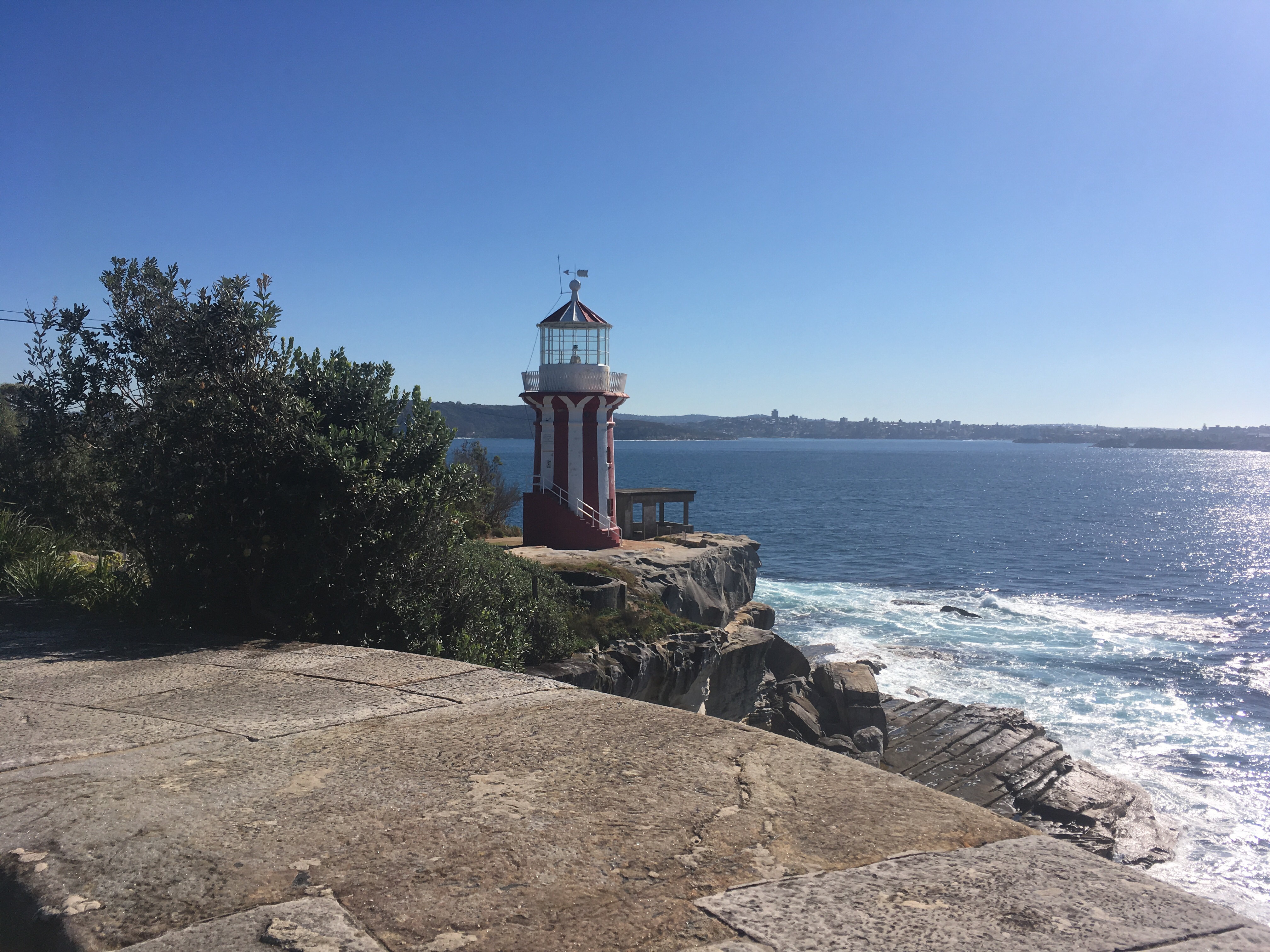
We soon came upon the first of the lighthouses. Hornby lighthouse had been made operational a year after a passenger ship struck rocks and sank nearby.


The area was filled with military history and one could see evidence of old underground tunnels beneath the artillery sites, now blocked off for safety.
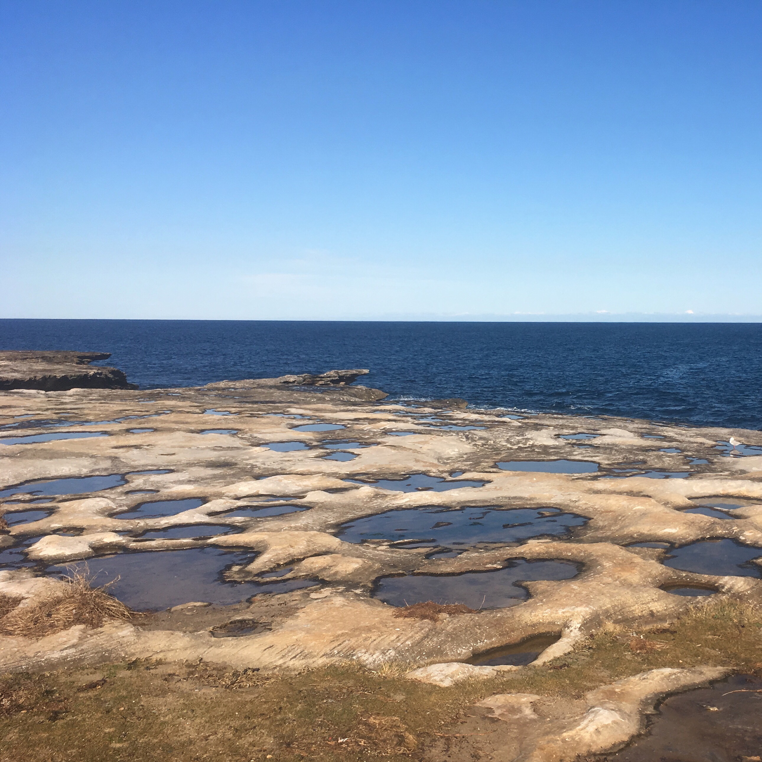
After a couple of confusing turns we found ourselves at “The Gap”. This place was once connected to the city by a tram and was a popular place to visit in times gone by. It is still very popular today. Geologically the main attraction is the tessellated rock at the base of the vertical cliff. It was quite impressive and my pictures don’t do it justice.
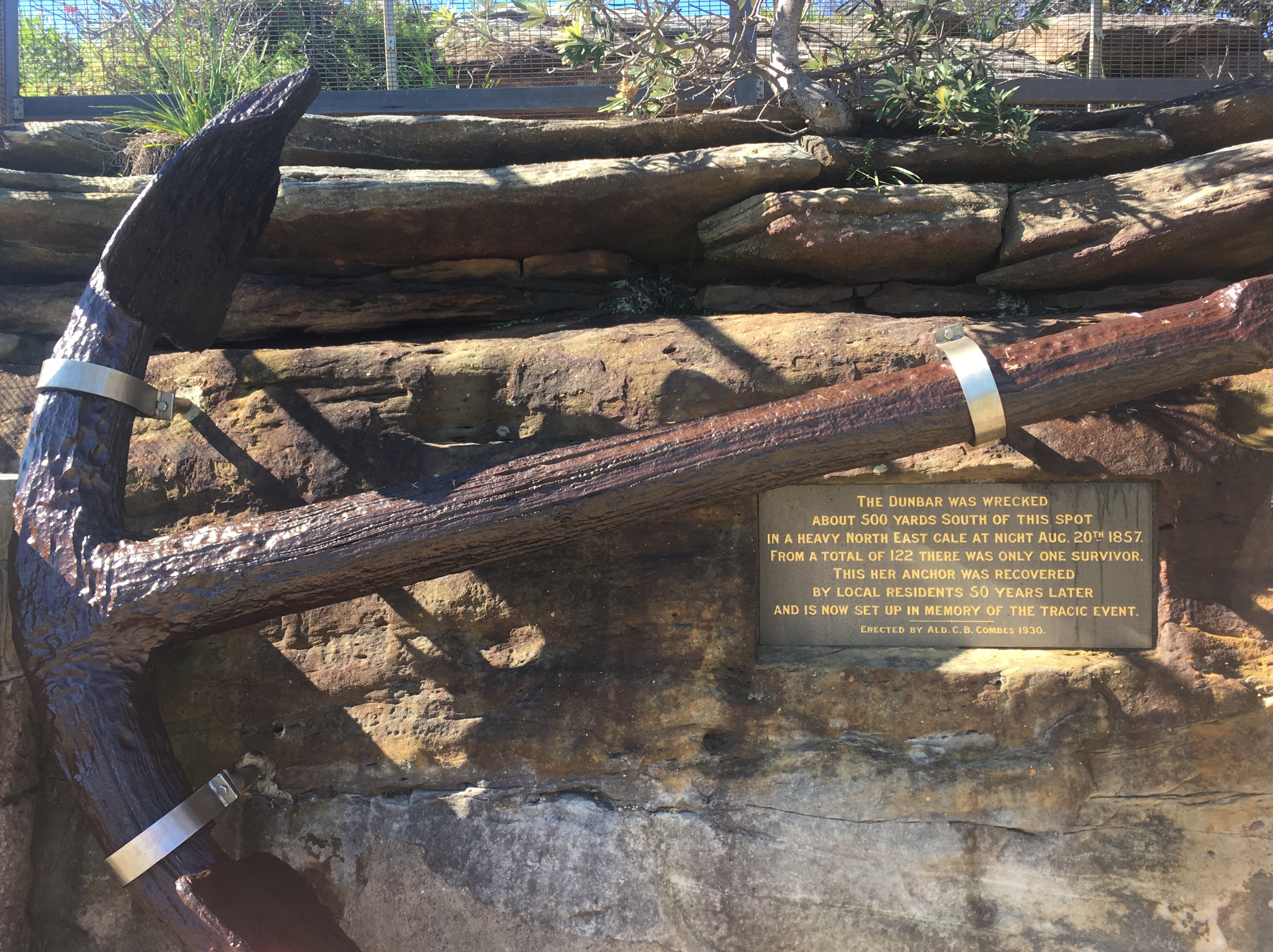
A bit further on we found the anchor from the wreck of the Dunbar, the shipwreck that we had read about at Hornby Lighthouse. Locals had found it and recovered it and it was now weather protected and tastefully displayed.


We next came upon an old signal station which was built in wartime. Shortly after we visited Macquarie Lighthouse which was Australia’s first, built in 1818.


We walked through the streets of Vaucluse and looked enviously at the sort of houses that the very wealthy could build.
We came upon a reserve in Dover Heights that we were surprised to learn was an old Radio Astronomy site. There had been a fixed “hole in the ground” type dish there, like a mini Arecibo observatory. It had made some significant findings related to supernovas but was now, sadly, just a football field and a sign.
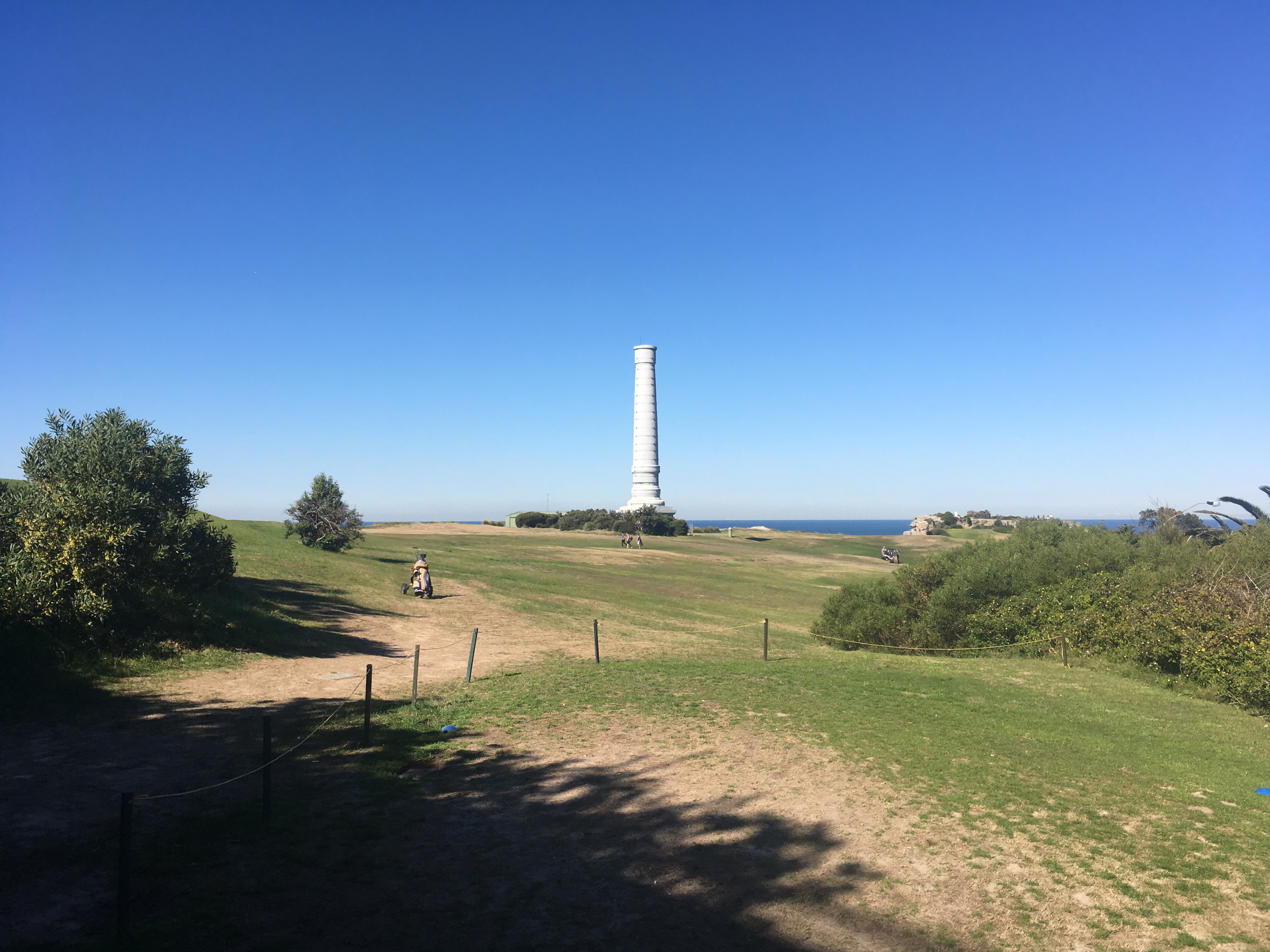
As we approached Bondi we saw a magnificent cylindrical tower dominating the view. I hadn’t heard of this monument before and wondered what it was all about. On googling it after the walk I discovered it was a ventilation pipe for the Bondi Sewerage Works! I think that one day, when the sewerage works are decommissioned, they could build an internal stairway and make this into a grand attraction. But it wasn’t quite so attractive now!
Soon we arrived at Bondi and were shocked at the shear number of posers! Young men with shirts off doing push ups and chin ups and the like, young women doing yoga in the most awkward of locations, randoms dancing away… It was like we had walked on to the set of Geordi Shore! Ugh, I never want to visit Bondi again. It’s definitely not a family friendly place. We stopped for lunch though and people-watched for a while.

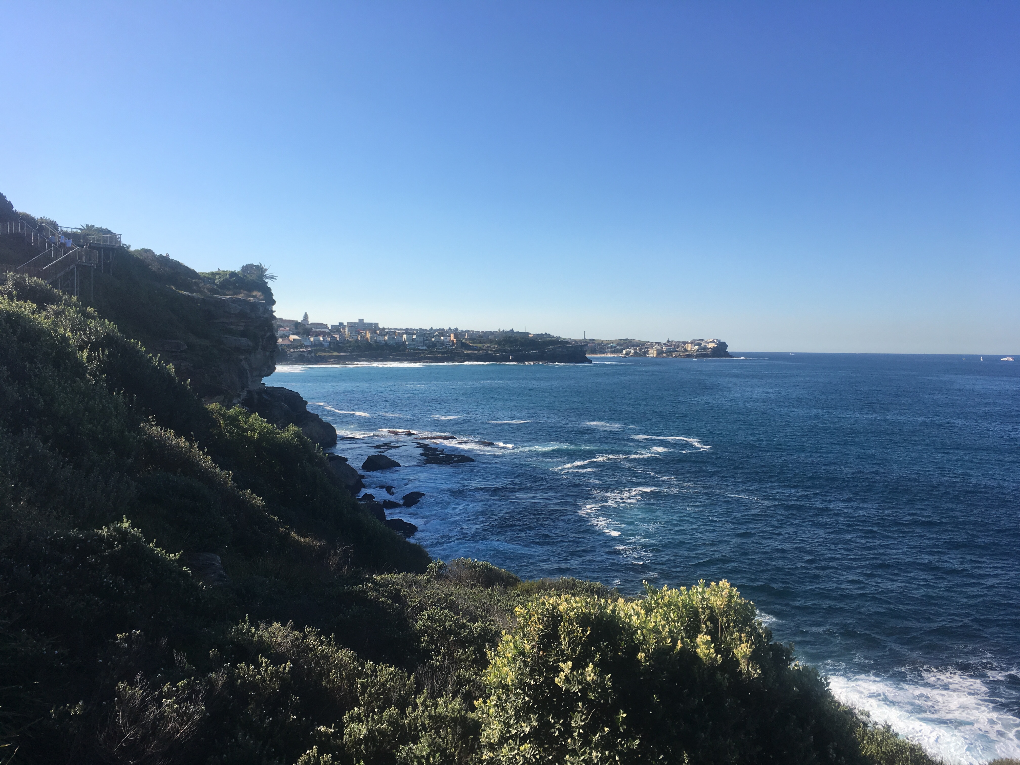
The next leg of this walk was the famed Bondi to Coogee walk and I have to say I’ll never recommend this to overseas guests. It was just too crowded and there was no historical sites to see. If the visitors were beach hopping and intended to swim at each beach then that would be worth it, but the walk itself was too busy for my liking. I didn’t even take more than a couple of pictures.
There were many, many “models” doing poses on the cliff edge for Instagram. One girl was standing on a wall with a shear drop on the other side. Tisk, kids today 🙂
On the plus side we did see a whale! I had wondered why there were so many people sitting on the cliffs then some guy shouted “whale”! There was a cluster of whale watching boats sitting close offshore. Just to the side of them an enormous whale leaped out of the water! We watched it perform several jumps. We were close enough to see the shape of its tail. I’ve never been lucky enough to see them so close to the shore, but I understand it’s not unusual.
One of the small bays we walked by featured an underwater trail. I’d never heard of this before but it was a route for divers and featured the marine creatures that lived in the bay. I thought this was an awesome idea and yet another reason to learn to swim…
We finally approached Coogee Beach and the difference to Bondi was clear. There were kids paddling in the water, families playing in the sand, trees lining the esplanade, and lots of spots to sit and have a picnic. This was more like it! Readers, if you are visiting Sydney with a family, avoid Bondi and head for Coogee!
Our walk was over after 4.5 hours and we were faring well. It was a very enjoyable walk, made even better having my sister for company. We chatted the entire way without a break, which is a most welcome change from quietly talking to myself on my solo hikes! Maybe I should consider joining a bushwalking group of some kind. It’s nice to have the company.
Thanks for reading. We are walking to raise funds for charity so please click here to donate. I very much appreciate the kind donations from my readers.

What an interesting walk! I like the rock formations at The Gap.
LikeLike
The gap is quite impressive at low tide as you see much more of the tessellated pavement. What I couldn’t photograph was a large overhang that is slowly becoming a sea cave. I hope it makes it.
LikeLiked by 1 person
Hi Nathan,
I’m an occasional visitor to your blog, mostly to pinch your ideas for walks. We seem to cover a lot of the same ground, though I think on average you seem to lean more heavily towards bush routes (proper hikes), and I probably go a bit further at a time. If you’re interested in a counterpart to the coastal walk (particularly to the Bondi-Manly route), you might be interested in an inner-harbour route I did, using the ferry network to hop around (https://medium.com/@btonkes/sydney-in-six-ferries-83a07f114150).
To add a bit of colour to Rodney Reserve being “an old Radio Astronomy site”, it’s the telescope from which Sagittarius A was determined to be the centre of the Milky Way galaxy (https://www.atnf.csiro.au/outreach/about/history/doverheights/index.html).
“This radio telescope was used to survey the sky for radio sources, and for a detailed study of a strong radio source that was detected in the constellation of Sagittarius. The radio astronomers realised that this source (called Sagittarius A) was located at the very centre of our Galaxy! These observations gained further fame for Australia and Dover Heights when in 1958 the International Astronomical Union decided to adopt the position of Sagittarius A as the coordinate centre for the system of galactic `latitude’ and `longitude’ that is still used today by all astronomers.”
… perhaps this is why people from Bondi assume themselves to be the centre of the universe!
Happy hiking,
brad
LikeLike